

Zeroing in on Meyer's Family Home
Using clues from a 1558 record to find an address

During our research into Meyer’s Basel family, Miriam traveled to Basel and located the primary source for a record mentioned by Dr. Arnold Lotz regarding a property bought by Joachim Meyer’s parents Jacob and Anna. The seller was Hans Thüring, likely a close family friend, whose first wife was godparent to one of the Meyer children. Thüring himself would later take on the guardianship of another sibling after Jakob Meyer’s death. The document describing the sale is dated November 24th, 1558 and located within record Gerichtsarchiv B 33. This purchase record is not precise as to the location of the house they bought, but does contain some small details and clues which allow us to hypothesize about an approximate address of their home. In this article we will explore the small hints the record offers and zoom in on Basel using contemporary maps.
You can explore all of our records about Meyer’s family here.
Update, March 2025: Precise house location found!
The Property Sale, 11/24/1558
Transcribed and translated by Miriam, emphasis mine:
There give for sale Hans Thüring the papermaker, citizen of Basel, and Magdalena Weck, his wife, together with him as her husband and advocate, whom she also turns to for advocacy and – as is well known – for what is bothersome and unavoidable to herself and their common heirs,
to Jacob Meyer the papermaker, citizen at Basel, who bought it legally for himself, his wife Anna Freund and in representation[?] of their common heirs,
the house and yard with the garden behind it with all legal rights[?] and what belongs with it, namely the one in the city of Basel, in the Saint Alban suburb at the linden, located between Peter Gutmann the winegrower and Michel Stocker the cooper the garden in the back borders the Rhine. Gives for this feature a rent of twenty shillings [unclear] pence to the monastery of Saint Alban in Basel each year and is not burdened by usury (or) connected with a liability other than what the sellers have stated and retained in good faith.
And for this the sale took place and was written as a cheque for sixty guilders in coin, specifically for each guilder a pound (and) five shillings of good stable Basel currency. With good[?] faith and a promise to constantly keep the sale [unclear]. It is [Latin:] promised in form.
Let’s use the bolded parts of this record to narrow down to where this house might have been located, utilizing and comparing maps of the city in 1552, 1607, 1612, and 1642 as visual aids.
First up: “in the city of Basel” for an easy start.
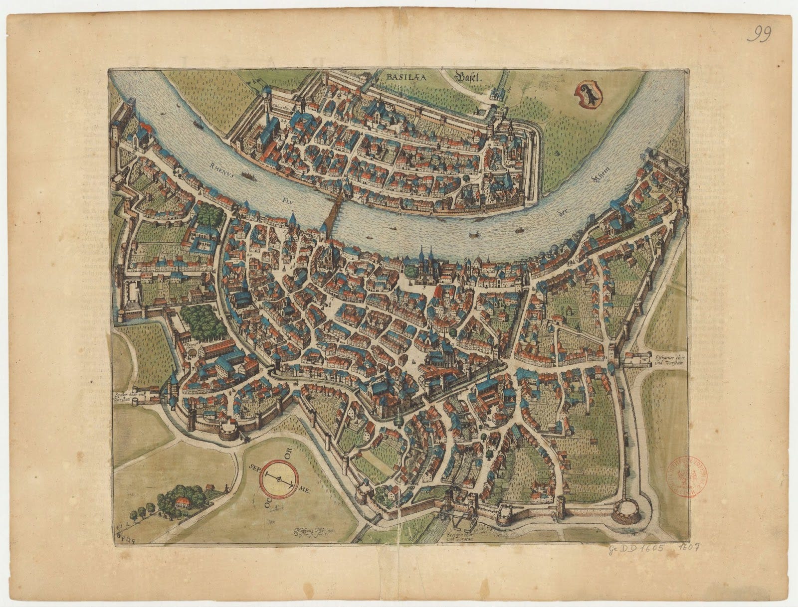
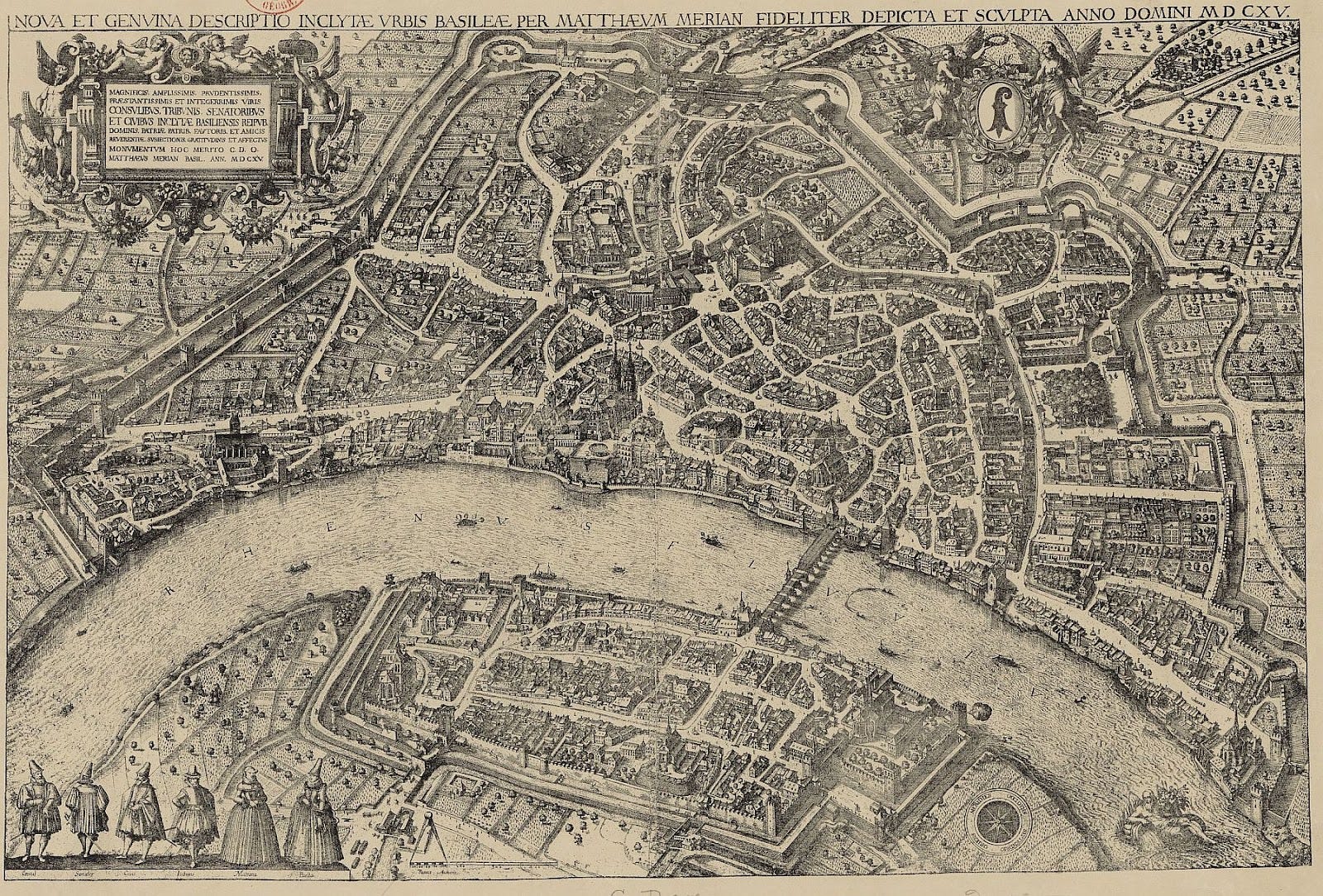
When comparing the maps from the early 17th century I saw no massive changes to the layout of the city, and most earlier maps (like the 1552 map I reference later on) are of a simpler art style rather than being accurate layouts of the city.
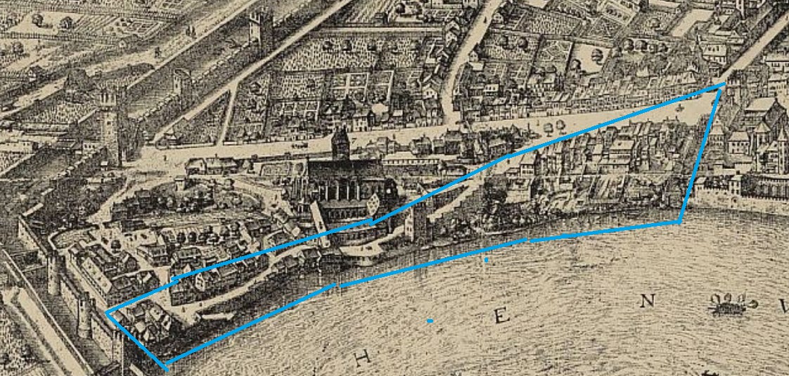
Next we can narrow down our search to “in the Saint Alban suburb”, the neighborhood of Basel where the paper makers, printers, and cutlers practiced, located on the east side of the city.
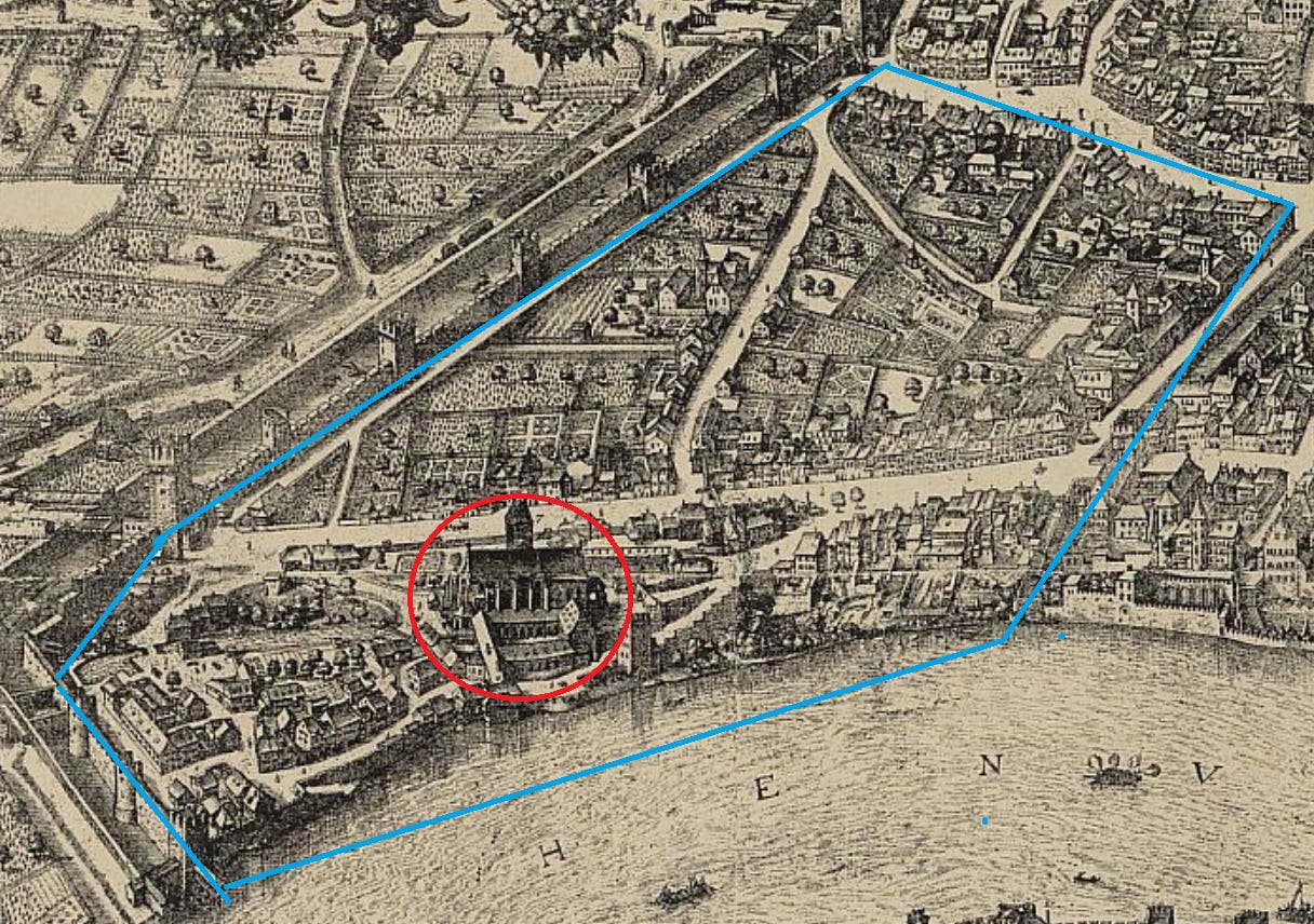
This neighborhood is pretty consistent in how it is depicted across almost 50 years of maps, with the major streets, big buildings, and the church of St Alban all illustrated in the same places.
Third, the mention of “the garden in the back [which] borders the Rhine” allows us to rule out a large number of possible properties, only including those along the riverside. I present this location below with a northern and southern perspective to showcase the similarities in the features.
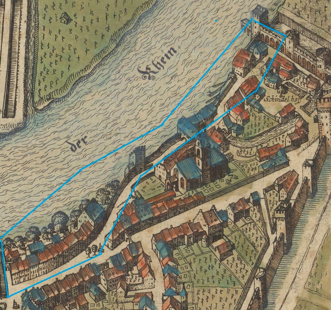
“...at the linden…” is a little more complicated. Located along the bank of the Rhine was the Lindentor, a tower that was used as a social venue, tavern, and more. However, our maps also include conspicuous trees planted next to our search area. At this intersection, the presence of a linden tree has been officially documented since at least the 18th century, with the current tree having been planted as a replacement in 1999.
It is impossible to tell if the trees which appear in our maps as early as 1552 were linden trees. Nonetheless it is a fun hypothesis, perhaps supported by the Central European custom of planting linden trees in the middle of settlements.
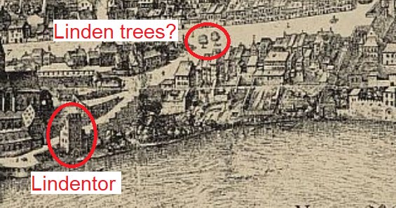
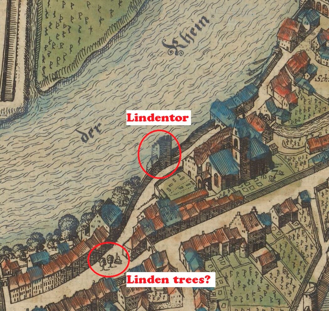
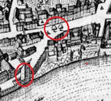
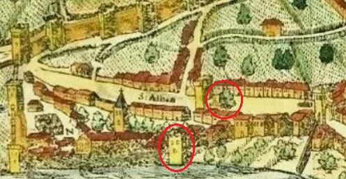
Both the Lindentor and the possible linden tree push our hypothetical address west, away from the eastern city walls.
The final clue is “...between Peter Gutmann the winegrower and Michel Stocker the cooper.” This doesn’t give us a ton of information, but points towards a block of buildings which allows for the possibility of neighbors.
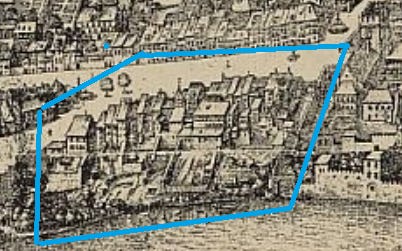
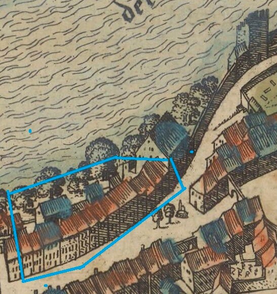
This step is fairly imprecise, amounting to “any house that’s not on the end of a block,” but this section of buildings is also one of the only ones along the Rhine that have a yard with the garden behind it to match the sale text. This block also has some old historical buildings still standing!
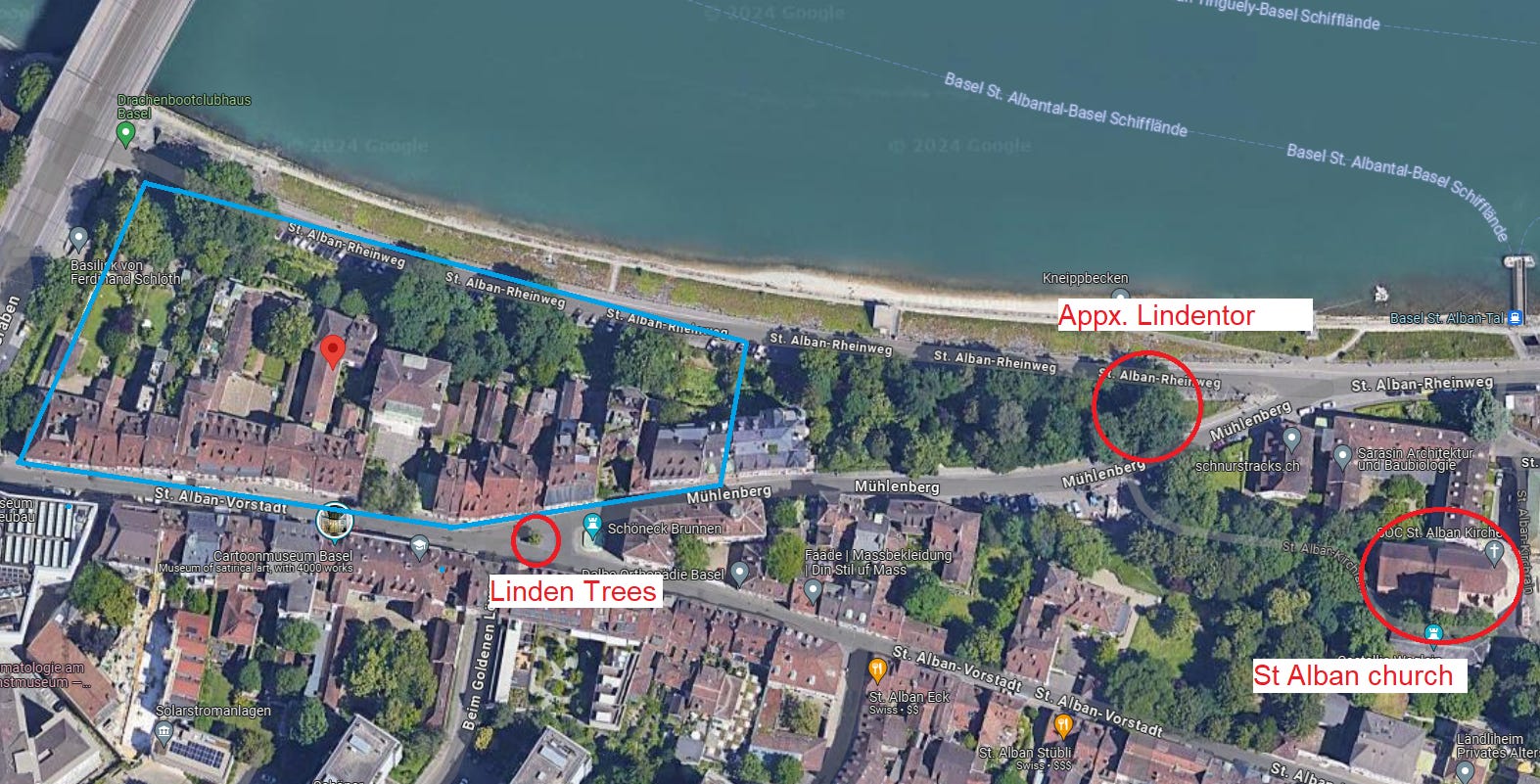
For example, one of the buildings in our illustration must be “Zum Hohen Dolder,” a house constructed in 1494 and used by local guildsmen as a banquet hall (among other uses). It was renovated in 1549, when Joachim was a child, and a feast was hosted there with over 100 guests. Perhaps his parents were in attendance to this affair!
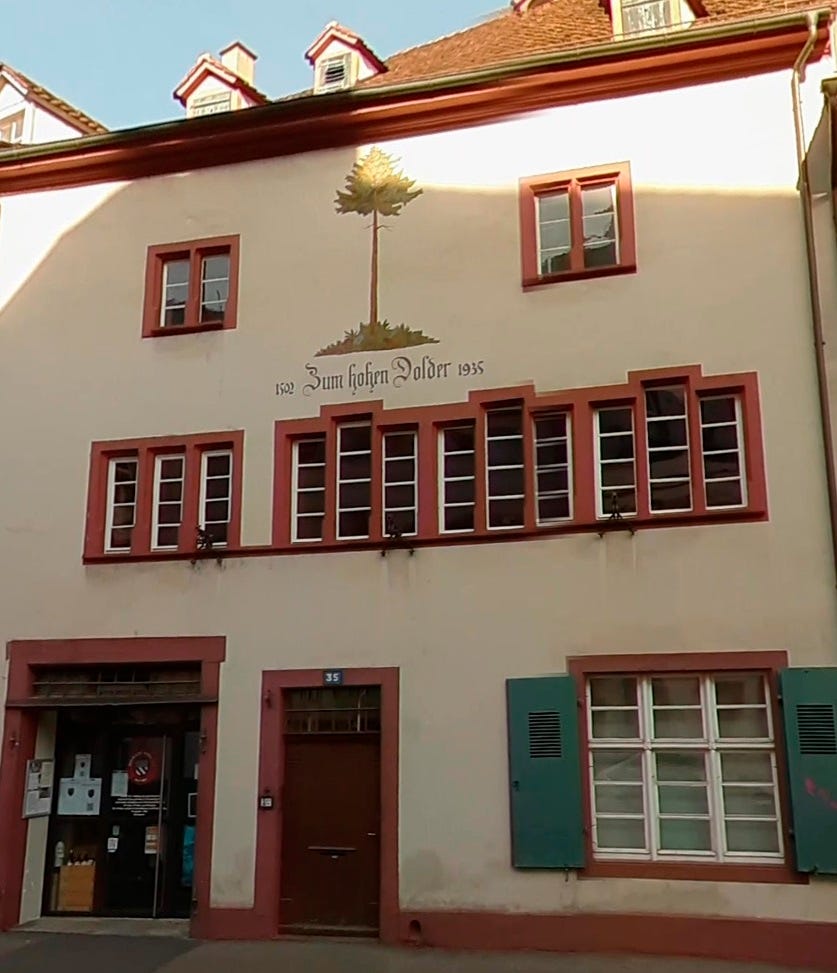
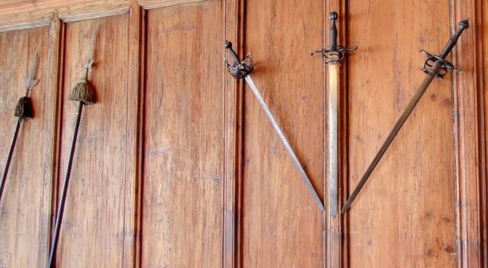
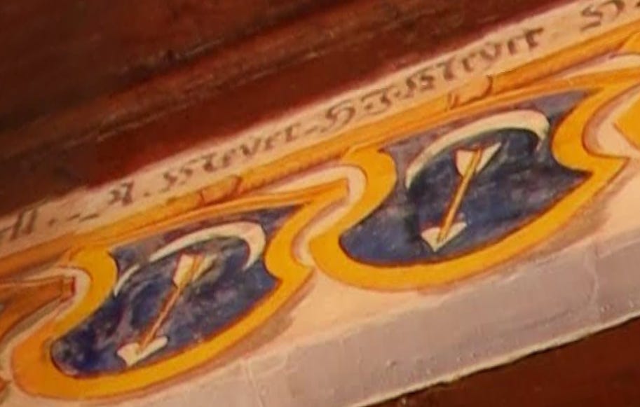
You can tour this building on Google Maps, and it has some interesting features such as swords hung on the wall, and the coat of arms (Wappen) of the large Meyer zum Pfeil family.
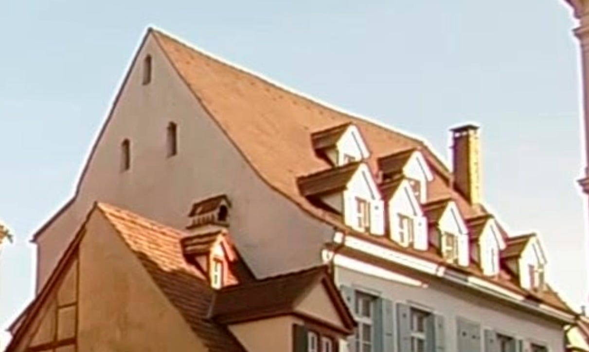
Additionally, the large building with the blue roof on the east side of the block may still exist based on the geometry and window placements along the side of the building. However, I was unable to find any solid data on it. If only there was a resource as brilliant as Jean-Michel Wendling’s “Maisons de Strasbourg” for Basel as well…
Conclusions and Further Research
This process is admittedly a bit imprecise and purely hypothetical in nature, but I feel that the context clues within the sales record are at least a little compelling. They cite specific locations, and if those locations could be identified on their own, we’d have a decent idea of where Meyer’s parents bought property. For example, definitely establishing “the linden” as a reference to the little trees, finding a separate property citation for either of the two neighbors, or perhaps a record from the St Alban monastery for the rent they were collecting could put more of a pin in our map. Even getting a list of which buildings along this block are “originals” could help us match up the modern street with the old maps and focus our digging a little more.
Still more to explore, perhaps on foot in the future!
Update, March 2025
We found the specific house! Read more about it in this follow up article!
You, the guys at The Art of Arms, are quite good at listing primary sources and providing citations. There's nothing wrong with approaching a post as a preprint (or parts of it) for a publication in an (historic or sports) academic journal. I think I saw a few for HEMA, and I'm happy to see that this is taking off as well. And you are clear about the speculative nature of today's post. So no worries.
On the other hand, I am (and plan to continue to be) very loose with my posts :), since I want my approach to be that of a pure hobby. And the last thing I want is to write more scientific papers when I want to relax.
Don't get me wrong, concrete evidence is great, but I think that a lot of people are ok with speculative investigations that result in compelling results, when it comes to trying to track details about the lives of the old masters.